Mapping trees as you plant
Many STA logger customers are involved in the treatment of invasive weeds in natural landscapes. But for quite a few of our conservation, forestry or carbon-neutral future customers, that is only a fraction of their work. They also spend long periods of the year planting trees and maintaining those trees by spraying the weeds that attempt to inundate them.
We have recently advocated for using the STA logger during planting maintenance/spraying activities to count or inventory trees in a forestry setting. That is, every spray is the location of a tree. But now we have plans to bring that workflow to the very beginning – Mapping the location of the trees as they are planted.
GPS mapping trees as you plant
So how is this done? A new device? A new subscription? No.
Users wanting to map trees as they plant them need to take their existing STA logger hardware and fix it to their planting equipment. You will need to purchase a new mount for this but that’s it – there is no new electronics or changes to the service. In addition to arming you with this new data, the idea is to dual use and maximise your investment in the STA logger solution.
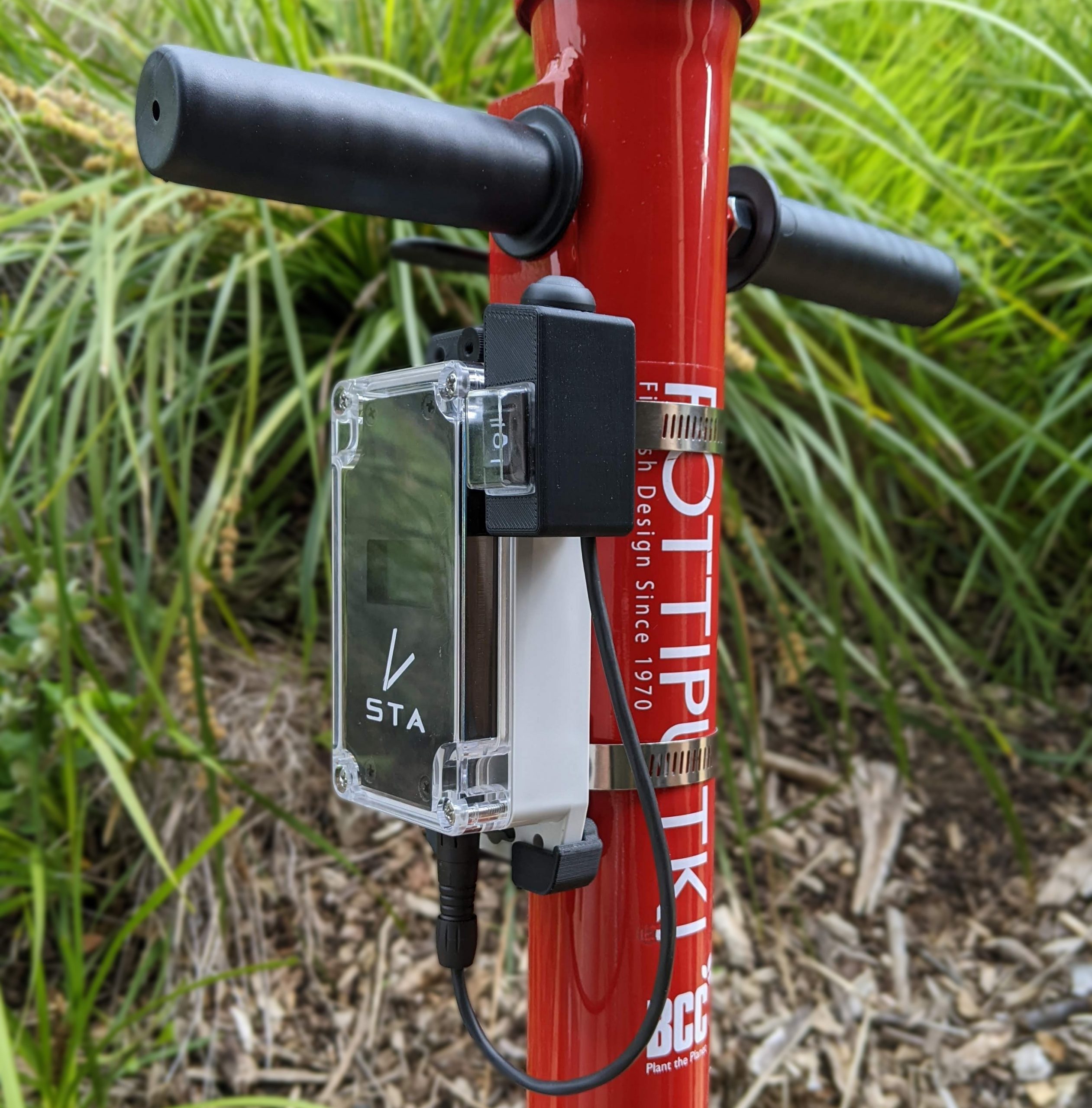
Pictured, is the STA logger mounted on a Pottiputki tree planter.

All you do, is when a tree is planted, you click the button that is situated near the handle. The date, time and location that the tree is installed will be recorded along with other standard STA logger metrics such as unit name, satellite count, HDOP, battery level, etc.
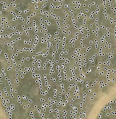
The outcome is, you will have full accountability of that tree from the minute it is installed in the ground. But on a plot scale, you will know your tree density, spatial pattern and will have it in an analysis and export ready platform.
An integrated tree mapping solution
This data is powerful enough as it is as it gives you the ability to quantify your forests at their birth. But it can be valuable in a full project management workflow. Consider the following example from the forestry industry.
The tree planting attachment is used during a planting project. The location of every tree is known and the forester estimates the tree density to be 1000 trees per hectare.
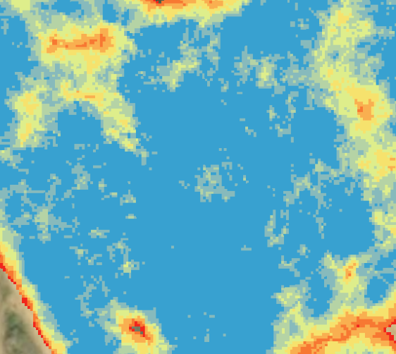
Shortly after, the team puts their STA loggers on their spraying equipment and conducts a maintenance run (or relief spray as it’s sometimes called). This involves spraying the herbaceous weeds that are growing at the base of the trees with herbicide so that the trees are not inundated and outcompeted. When back in the office, the forest manager analysis the data and identifies that there are 900 spray points per hectare, indicating that they have lost 100 trees per hectare (or 10%). This is fine as it is still in their target density range.
Shortly after, the conduct another maintenance run and identify that the number has dropped again, to 800 spray points per hectare. This represents 20% losses and has crossed a threshold. Now they know they need to replant. They analyse the data and identify locations where the density is low and where they should focus their infill planting.
Again, using the STA logger attachment, they will have records of every infill plant that was installed.
Other planting and mapping solutions
At the time of writing, the tree planting mapping attachment is in the prototype stage, so it is not commercially available (though you can reach out to be involved in the beta trial). We are currently developing it to suit the Pottiputki tree planter, but we also intend to make flexible so that it can suit other tree planting hardware.
And we’re not stopping there. We also hope to be able to fix it to survey poles so it can be used in a more general situation such as when conducting woody weed control with saws or simply mapping site features.
Recent Posts

STA onboarding
Read More »
So, why the STA logger?
Read More »
Post processing STA Explorer HA data
Read More »
Accurate tree planting mapping – Using the STA explorer HA
Read More »